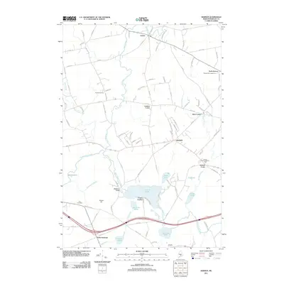
2011 Map of Hermon
USGS Topo · Published 2011About this map
Souadabscook Stream and Black Stream drain a landscape defined by glacial ponds and small crossroads communities in this early 21st-century study of Penobscot County. The area is anchored by the larger waters of Hermon Pond and Hammond Pond, around which small hamlets like Fowler Landing and Hermon Center are situated. The settlement pattern reflects a mix of traditional New England intersections such as Leathers Corner and Snow Corner, alongside newer developments and established campsites like the Pleasant Hill Campground. Genealogists may find value in the specific locations of rural burial grounds, including the Pine Tree Cemetery and Rug le Cemetery. The terrain is relatively low-lying, with Hinkley Hill providing one of the few named topographic elevations in a region dominated by marshes and slow-moving streams.
Find a feature on this map
100 named features on this map. Tap any name to fly to it.
Don’t see what you’re looking for? This feature index may not catch every label — zoom into the map to look around manually.
Map Details
Editions of this 2011 Hermon Map
This is the sole edition of this map. No revisions or reprints were ever made.
Other maps of this area

1900 · Bucksport
USGS Topo · 1:62,500

1902 · Bucksport
USGS Topo · 1:62,500

1902 · Bangor
USGS Topo · 1:62,500

1931 · Stetson
USGS Topo · 1:48,000

1932 · Brooks
USGS Topo · 1:62,500

1935 · Stetson
USGS Topo · 1:62,500

1942 · Bangor
USGS Topo · 1:62,500

1942 · Bucksport
USGS Topo · 1:62,500

1946 · Bangor
USGS Topo · 1:62,500

1948 · Bangor
USGS Topo · 1:250,000