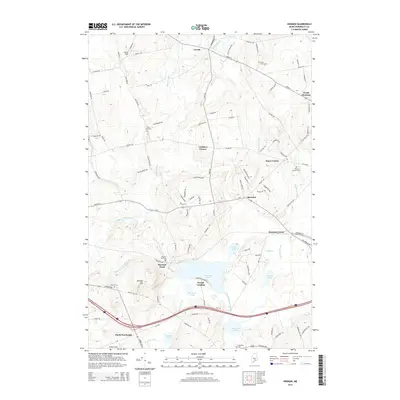
2014 Map of Hermon
USGS Topo · Published 2014About this map
Hermon Pond and its surrounding wetlands form the center of this Penobscot County landscape, where the Souadabscook Stream and Patten Stream converge. Small settlements like Leathers Corner, Snow Corner, and Hermon Center are linked by a dense network of country roads including Fuller Rd and Union St. The map reflects a classic Maine rural-suburban pattern, with newer residential lanes like Timberview Dr and Bonnie Lea Dr branching off older established routes. For genealogists and local historians, several small burial grounds are documented, such as Birch Grove Cem and Ruggle Cem. The area’s aviation and agricultural legacy is noted through local landmarks like Griffin Field near Levant and Miller's Field to the south. Notable water bodies including Hammond Pond, Tracy Pond, and Pug Pond highlight the importance of the local drainage system to the region's development.
Find a feature on this map
107 named features on this map. Tap any name to fly to it.
Don’t see what you’re looking for? This feature index may not catch every label — zoom into the map to look around manually.
Map Details
Editions of this 2014 Hermon Map
This is the sole edition of this map. No revisions or reprints were ever made.
Other maps of this area

1900 · Bucksport
USGS Topo · 1:62,500

1902 · Bucksport
USGS Topo · 1:62,500

1902 · Bangor
USGS Topo · 1:62,500

1931 · Stetson
USGS Topo · 1:48,000

1932 · Brooks
USGS Topo · 1:62,500

1935 · Stetson
USGS Topo · 1:62,500

1942 · Bangor
USGS Topo · 1:62,500

1942 · Bucksport
USGS Topo · 1:62,500

1946 · Bangor
USGS Topo · 1:62,500

1948 · Bangor
USGS Topo · 1:250,000