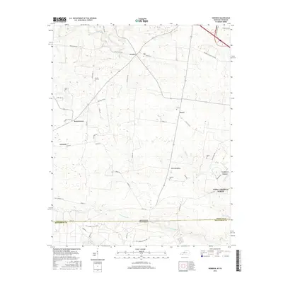
2016 Map of Herndon
USGS Topo · Published 2016About this map
Herndon and LaFayette anchor this survey of the agrarian landscape along the Kentucky Tennessee border, where the terrain is marked by a network of small streams and numerous family burial sites. The presence of Major Cem, Double Barn Cem, and McKnight Cem provides essential spatial data for genealogists tracking local families in this corner of Christian County. The map captures the interface between traditional rural life and modern defense operations, with the southern portion dominated by the Fort Campbell Military Res and the infrastructure of Campbell Army Airfield (Fort Campbell). Water features like Noahs Spring Br and Dry Fork Cr define the drainage patterns of the area, while established routes such as Old Clarksville Pike and Lonnie Walker Hwy link the small communities of Bennettstown, Howel, and Garrettsburg.
Find a feature on this map
49 named features on this map. Tap any name to fly to it.
Don’t see what you’re looking for? This feature index may not catch every label — zoom into the map to look around manually.
Map Details
Editions of this 2016 Herndon Map
This is the sole edition of this map. No revisions or reprints were ever made.
Other maps of this area

1944 · Clarksville
USGS Topo · 1:50,000

1950 · Caledonia
USGS Topo · 1:24,000

1951 · Church Hill
USGS Topo · 1:24,000

1951 · Caledonia
USGS Topo · 1:24,000

1951 · Hopkinsville
USGS Topo · 1:24,000

1951 · Roaring Spring
USGS Topo · 1:24,000

1951 · New Providence
USGS Topo · 1:24,000

1951 · Indian Mound
USGS Topo · 1:24,000

1951 · Herndon
USGS Topo · 1:24,000

1951 · Oak Grove
USGS Topo · 1:24,000