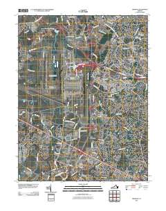
2010 Map of Herndon
USGS Topo · Published 2010About this map
Washington Dulles International Airport dominates the western landscape of this northern Virginia quadrangle, reflecting the late 20th-century evolution of the region from agrarian roots into a major aviation and technology hub. Traces of the area's older history remain visible through landmarks like Sully Plantation and Kidwell Farm, while the town of Herndon and communities like Chantilly and Sterling Park show the dense suburban infill typical of the era.
Find a feature on this map
87 named features on this map. Tap any name to fly to it.
Don’t see what you’re looking for? This feature index may not catch every label — zoom into the map to look around manually.
Map Details
Editions of this 2010 Herndon Map
This is the sole edition of this map. No revisions or reprints were ever made.
Other maps of this area

1884 · Harpers Ferry
USGS Topo · 1:125,000

1890 · Mt. Vernon
USGS Topo · 1:125,000

1891 · Harpers Ferry
USGS Topo · 1:125,000

1891 · Mt. Vernon
USGS Topo · 1:125,000

1893 · Frederick
USGS Topo · 1:125,000

1893 · Harpers Ferry
USGS Topo · 1:125,000

1894 · Warrenton
USGS Topo · 1:125,000

1894 · Frederick
USGS Topo · 1:125,000

1894 · Mt. Vernon
USGS Topo · 1:125,000

1897 · Mt. Vernon
USGS Topo · 1:125,000