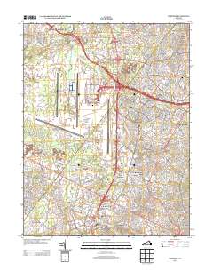
2013 Map of Herndon
USGS Topo · Published 2013About this map
Dulles International Airport dominates the northwestern landscape of this Fairfax County region, with its extensive runway system and landmarks like the Donald D. Engen Observation Tower and Dulles Distribution Park illustrating the modern infrastructure of the early 21st century. In stark contrast to the massive transit hub, the map records the enduring footprints of earlier eras through sites like Sully Plantation and long-standing communities such as Floris, Navy, and Lees Corner.
Find a feature on this map
50 named features on this map. Tap any name to fly to it.
Don’t see what you’re looking for? This feature index may not catch every label — zoom into the map to look around manually.
Map Details
Editions of this 2013 Herndon Map
This is the sole edition of this map. No revisions or reprints were ever made.
Other maps of this area

1884 · Harpers Ferry
USGS Topo · 1:125,000

1890 · Mt. Vernon
USGS Topo · 1:125,000

1891 · Harpers Ferry
USGS Topo · 1:125,000

1891 · Mt. Vernon
USGS Topo · 1:125,000

1893 · Frederick
USGS Topo · 1:125,000

1893 · Harpers Ferry
USGS Topo · 1:125,000

1894 · Warrenton
USGS Topo · 1:125,000

1894 · Frederick
USGS Topo · 1:125,000

1894 · Mt. Vernon
USGS Topo · 1:125,000

1897 · Mt. Vernon
USGS Topo · 1:125,000