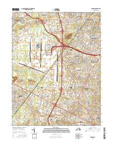
2016 Map of Herndon
USGS Topo · Published 2016About this map
Sully Plantation stands at the heart of this Northern Virginia landscape, which is defined by the expansive grounds of the Washington Dulles International Airport and its associated infrastructure. The transition from the rural past of Fairfax and Loudoun counties to a major transportation and technology corridor is evident in the proximity of family burial grounds, such as the Orrison Family Cem and Hutchison Major Family Cem, to modern developments like ITT Technical Institute - Chantilly. Waterways including Horsepen Run and Cub Run drain the Culpeper Basin, providing a natural backdrop to the suburban growth seen in Reston, Herndon, and Ashburn. Several historic faith centers, including the Mount Pleasant Baptist Church and Chantilly Baptist Church, remain as community anchors amid the evolving road networks and business parks.
Find a feature on this map
288 named features on this map. Tap any name to fly to it.
Don’t see what you’re looking for? This feature index may not catch every label — zoom into the map to look around manually.
Map Details
Editions of this 2016 Herndon Map
This is the sole edition of this map. No revisions or reprints were ever made.
Other maps of this area

1884 · Harpers Ferry
USGS Topo · 1:125,000

1890 · Mt. Vernon
USGS Topo · 1:125,000

1891 · Harpers Ferry
USGS Topo · 1:125,000

1891 · Mt. Vernon
USGS Topo · 1:125,000

1893 · Frederick
USGS Topo · 1:125,000

1893 · Harpers Ferry
USGS Topo · 1:125,000

1894 · Warrenton
USGS Topo · 1:125,000

1894 · Frederick
USGS Topo · 1:125,000

1894 · Mt. Vernon
USGS Topo · 1:125,000

1897 · Mt. Vernon
USGS Topo · 1:125,000