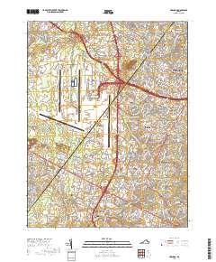
2019 Map of Herndon
USGS Topo · Published 2019About this map
Washington Dulles International Airport dominates the central landscape of this western Fairfax County corridor, serving as a massive hub of infrastructure that defines the local geography. Surrounding the airfield, established communities like Herndon and Chantilly sit alongside newer residential developments such as Franklin Farm and McNair. The map captures a high degree of preservation amidst rapid suburban growth, evidenced by the presence of Sully Plantation and several historic family burial grounds including the Orrison Family Cem and Thompson Family Cem. Waterways like Horsepen Run and Cub Run still wind through the modern road network, which includes the Dulles Toll Rd and Fairfax Co Pkwy. Local religious history is well-represented by long-standing landmarks such as the Frying Pan Baptist Meeting House Cem, rooting the contemporary landscape in its 18th and 19th-century foundations.
Find a feature on this map
53 named features on this map. Tap any name to fly to it.
Don’t see what you’re looking for? This feature index may not catch every label — zoom into the map to look around manually.
Map Details
Editions of this 2019 Herndon Map
This is the sole edition of this map. No revisions or reprints were ever made.
Other maps of this area

1884 · Harpers Ferry
USGS Topo · 1:125,000

1890 · Mt. Vernon
USGS Topo · 1:125,000

1891 · Harpers Ferry
USGS Topo · 1:125,000

1891 · Mt. Vernon
USGS Topo · 1:125,000

1893 · Frederick
USGS Topo · 1:125,000

1893 · Harpers Ferry
USGS Topo · 1:125,000

1894 · Warrenton
USGS Topo · 1:125,000

1894 · Frederick
USGS Topo · 1:125,000

1894 · Mt. Vernon
USGS Topo · 1:125,000

1897 · Mt. Vernon
USGS Topo · 1:125,000