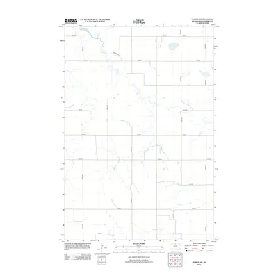
2012 Map of Herreid SW
USGS Topo · Published 2012About this map
Spring Cr meanders across this rural section of Campbell County, South Dakota, defining the natural drainage and topographic character of the region. The landscape is structured by a methodical grid of gravel roads and section lines, including 300th Ave and 301st Ave, which reveal the enduring importance of the township-and-range survey system in the Great Plains. This 2012 survey illustrates the transition toward modern digital mapping while preserving the exact layout of long-established agricultural corridors. Aside from the prominent waterway, the area is marked by a network of rural routes such as Spring Valley Pl and 105th St, reflecting the sparse, wide-open settlement pattern common to this portion of north-central South Dakota.
Find a feature on this map
18 named features on this map. Tap any name to fly to it.
Don’t see what you’re looking for? This feature index may not catch every label — zoom into the map to look around manually.
Map Details
Editions of this 2012 Herreid SW Map
This is the sole edition of this map. No revisions or reprints were ever made.
Other maps of this area

1953 · McIntosh
USGS Topo · 1:250,000

1958 · McIntosh
USGS Topo · 1:250,000

1965 · Herreid NW
USGS Topo · 1:24,000

1965 · Herreid SW
USGS Topo · 1:24,000

1965 · Herreid NE
USGS Topo · 1:24,000

1965 · Herreid
USGS Topo · 1:24,000

1965 · Pollock SE
USGS Topo · 1:24,000

1965 · Pollock
USGS Topo · 1:24,000

1967 · Mound City
USGS Topo · 1:24,000

1967 · Mobridge NE
USGS Topo · 1:24,000