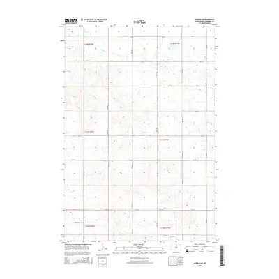
2015 Map of Herreid SW
USGS Topo · Published 2015About this map
Spring Cr meanders across this rural landscape in northern South Dakota, carving a path through the rolling sections of Campbell County. This 2015 survey illustrates a region defined by the rigid precision of the Public Land Survey System, with township and range lines such as t127n r78w and t127n r77w organizing the vast agricultural tracts. The infrastructure is characterized by a strict grid of section-line roads, including 300th Ave and 301st Ave, which provide access to the isolated farmsteads typical of the Missouri Plateau. In the southwestern portion of the sheet, Vanbeek Rd serves as a local landmark near the township boundary, while the numerous small basins and contour variations indicate the complex drainage patterns feeding into the creek system. This map documents the enduring layout of prairie homesteads and the persistent importance of water management in a high-plains environment.
Find a feature on this map
23 named features on this map. Tap any name to fly to it.
Don’t see what you’re looking for? This feature index may not catch every label — zoom into the map to look around manually.
Map Details
Editions of this 2015 Herreid SW Map
This is the sole edition of this map. No revisions or reprints were ever made.
Other maps of this area

1953 · McIntosh
USGS Topo · 1:250,000

1958 · McIntosh
USGS Topo · 1:250,000

1965 · Herreid NW
USGS Topo · 1:24,000

1965 · Herreid SW
USGS Topo · 1:24,000

1965 · Herreid NE
USGS Topo · 1:24,000

1965 · Herreid
USGS Topo · 1:24,000

1965 · Pollock SE
USGS Topo · 1:24,000

1965 · Pollock
USGS Topo · 1:24,000

1967 · Mound City
USGS Topo · 1:24,000

1967 · Mobridge NE
USGS Topo · 1:24,000