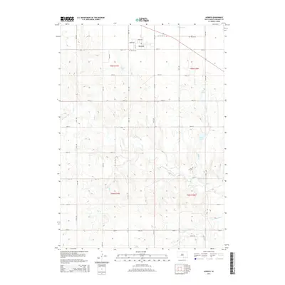
2015 Map of Herrick
USGS Topo · Published 2015About this map
The town of Herrick serves as the central hub of this Gregory County landscape, situated near the northern edge of the survey where Sparks Ave and Herrick Ave intersect. The surrounding prairie is defined by a dense network of watercourses, most notably the winding path of Ponca Cr and the eponymous Herrick Lake. Local history and genealogy are anchored by the Herrick Cem just south of the main settlement and the Ponca Creek Cem further south. The land is carved by numerous drainages including Blue Eyes Cr, Hay Cr, and the notably named Oscar Micheaux Cr, reflecting the diverse naming traditions of the South Dakota plains. A systematic grid of section roads like 296th St and 300th St overlays the terrain, illustrating the organized agricultural development of the region.
Find a feature on this map
27 named features on this map. Tap any name to fly to it.
Don’t see what you’re looking for? This feature index may not catch every label — zoom into the map to look around manually.
Map Details
Editions of this 2015 Herrick Map
This is the sole edition of this map. No revisions or reprints were ever made.
Other maps of this area

1951 · Naper
USGS Topo · 1:24,000

1955 · Mitchell
USGS Topo · 1:250,000

1955 · O'Neill
USGS Topo · 1:250,000

1959 · O'Neill
USGS Topo · 1:250,000

1959 · Mitchell
USGS Topo · 1:250,000

1964 · Gregory SE
USGS Topo · 1:24,000

1964 · Herrick NW
USGS Topo · 1:24,000

1964 · Herrick NE
USGS Topo · 1:24,000

1964 · St. Charles
USGS Topo · 1:24,000
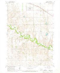
1964 · Herrick
USGS Topo · 1:24,000