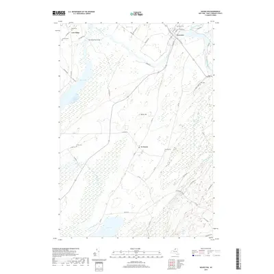
2019 Map of Heuvelton
USGS Topo · Published 2019About this map
The Oswegatchie River snakes through the northern landscape of Saint Lawrence County, anchoring the village of Heuvelton. This 2019 survey documents a rural New York environment defined by extensive wetlands and water systems, including the northern reaches of Black Lake and its Lower Big Bay, alongside Mud Lake and the meandering Beaver Creek. The settlement pattern is distinctly focused on historic crossroads and elevated terrain, such as Barter Hill and Mt Lona.
Find a feature on this map
57 named features on this map. Tap any name to fly to it.
Don’t see what you’re looking for? This feature index may not catch every label — zoom into the map to look around manually.
Map Details
Editions of this 2019 Heuvelton Map
This is the sole edition of this map. No revisions or reprints were ever made.
Other maps of this area

1904 · Ogdensburg
USGS Topo · 1:62,500

1905 · Ogdensburg
USGS Topo · 1:62,500

1906 · Brier Hill
USGS Topo · 1:62,500

1912 · Hammond
USGS Topo · 1:62,500

1915 · Gouverneur
USGS Topo · 1:62,500

1937 · Gouverneur
USGS Topo · 1:62,500

1943 · Ogdensburg East
USGS Topo · 1:31,680

1943 · Rensselaer Falls
USGS Topo · 1:31,680

1943 · Lisbon
USGS Topo · 1:31,680

1943 · Edwardsville
USGS Topo · 1:31,680