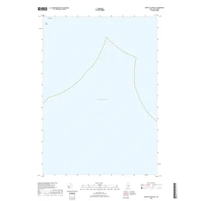
2018 Map of Hewett Island OE S
USGS Topo · Published 2018About this map
Hog Island and its adjacent rock, The Nubble, stand as the primary landforms in this maritime survey of the Knox County coastline. Most of the sheet is occupied by the open waters of the Atlantic Ocean, illustrating the isolated nature of the islands within the Matinicus Isle Plantation area. This specific 2018 survey documents the precise coastal boundaries and terrain elevations of these small landmasses, which serve as critical navigation points for those traversing the Maine waters. The map provides a clear look at the minimal terrestrial footprint of these islands relative to the surrounding sea, capturing a quiet corner of the New England coast.
Find a feature on this map
3 named features on this map. Tap any name to fly to it.
Don’t see what you’re looking for? This feature index may not catch every label — zoom into the map to look around manually.
Map Details
Editions of this 2018 Hewett Island OE S Map
This is the sole edition of this map. No revisions or reprints were ever made.
Other maps of this area

1904 · Tenants Harbor
USGS Topo · 1:62,500

1906 · Matinicus
USGS Topo · 1:62,500

1906 · Tennant Harbor
USGS Topo · 1:62,500

1948 · Bath
USGS Topo · 1:250,000
1955 · Hewett Island
USGS Topo · 1:24,000
1955 · Tenants Harbor
USGS Topo · 1:24,000

1956 · Bath
USGS Topo · 1:250,000

1957 · Bath
USGS Topo · 1:250,000

1958 · Bath
USGS Topo · 1:250,000

1963 · Bath
USGS Topo · 1:250,000