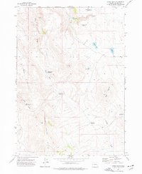
1972 Map of Hickey Basin
USGS Topo · Published 1977About this map
The high-desert terrain of Malheur County, Oregon, is defined by an intricate network of water management features and cattle-ranching infrastructure in this 1970s survey. The landscape is characterized by numerous small reservoirs such as Andy Wilson Reservoir and Walls Reservoir, illustrating the critical role of water storage in this arid region. The drainage system of McEwen Creek and Crowley Creek cuts through the uplands, leading toward the prominent elevations of Dry Buttes. Human presence is marked by utility and transportation, including a remote Landing Strip and a winding Jeep Trail that traverses the northern sections. Notable family-named landmarks like Atterbury Reservoir and Bar Heart Reservoir provide valuable clues for genealogists tracking local land use and residency during the late 20th century, while the presence of Swamp Creek Buttes highlights the varied geological formations that rise above the basin floor.
Find a feature on this map
20 named features on this map. Tap any name to fly to it.
Don’t see what you’re looking for? This feature index may not catch every label — zoom into the map to look around manually.
Map Details
Editions of this 1972 Hickey Basin Map
This is the sole edition of this map. No revisions or reprints were ever made.
Other maps of this area

1955 · Burns
USGS Topo · 1:250,000

1955 · Boise
USGS Topo · 1:250,000

1958 · Burns
USGS Topo · 1:250,000

1958 · Boise
USGS Topo · 1:250,000

1959 · Burns
USGS Topo · 1:250,000

1962 · Boise
USGS Topo · 1:250,000

1972 · Shumway Reservoir
USGS Topo · 1:24,000

1972 · Crowley
USGS Topo · 1:24,000
1972 · Star Creek Reservoir
USGS Topo · 1:24,000
1972 · Mc Ewen Butte
USGS Topo · 1:24,000