
1972 Map of Shumway Reservoir
USGS Topo · Published 1975About this map
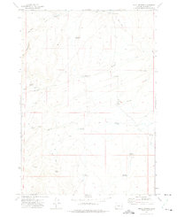
Shumway Ranch sits at the heart of this high-desert ranching landscape in Malheur County, where water management is the defining feature of the terrain. The 1972 survey reveals an extensive network of small-scale impoundments and catchments necessary for livestock and survival in this arid environment, including Arrien Reservoir, Shumway Reservoir, and Skull Springs Reservoir. These man-made features are connected by a system of primitive routes such as the Jeep Trail, illustrating how remote operations were maintained before modern infrastructure. The map also records early 20th-century remnants at Creston and numerous family-named landmarks like McConnell Springs and Arrien Res No 6. This concentration of localized water sources and named springs like Fenton Spring and Wire Corral Springs provides critical data for those researching the agricultural history and land-use patterns of eastern Oregon.
Find a feature on this map
37 named features on this map. Tap any name to fly to it.
Don’t see what you’re looking for? This feature index may not catch every label — zoom into the map to look around manually.
Map Details
Editions of this 1972 Shumway Reservoir Map
This is the sole edition of this map. No revisions or reprints were ever made.
Other maps of this area

1955 · Burns
USGS Topo · 1:250,000

1955 · Boise
USGS Topo · 1:250,000

1958 · Burns
USGS Topo · 1:250,000

1958 · Boise
USGS Topo · 1:250,000

1959 · Burns
USGS Topo · 1:250,000

1962 · Boise
USGS Topo · 1:250,000

1972 · Tims Peak
USGS Topo · 1:24,000

1972 · Alder Creek
USGS Topo · 1:24,000
1972 · Skull Springs
USGS Topo · 1:24,000
1972 · Star Creek Reservoir
USGS Topo · 1:24,000