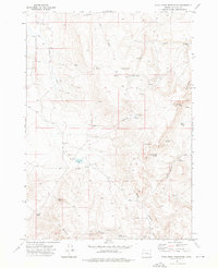
1972 Map of Star Creek Reservoir
USGS Topo · Published 1976About this map
Rodger Ranch and the isolated Sutherland Cabin anchor this high-desert landscape in Malheur County during the early 1970s. The map illustrates a remote terrain defined by vital water sources and volcanic landmarks, where life is dictated by the availability of springs and the rugged paths of Jeep Trails. Significant topographic features like the jagged Roostercomb and the prominent Star Mountain rise above a network of drainages including Dry Creek and Skull Creek.
Find a feature on this map
40 named features on this map. Tap any name to fly to it.
Don’t see what you’re looking for? This feature index may not catch every label — zoom into the map to look around manually.
Map Details
Editions of this 1972 Star Creek Reservoir Map
This is the sole edition of this map. No revisions or reprints were ever made.
Other maps of this area

1955 · Burns
USGS Topo · 1:250,000

1955 · Boise
USGS Topo · 1:250,000

1958 · Burns
USGS Topo · 1:250,000

1958 · Boise
USGS Topo · 1:250,000

1959 · Burns
USGS Topo · 1:250,000

1962 · Boise
USGS Topo · 1:250,000

1972 · Burnt Flat
USGS Topo · 1:24,000

1972 · Shumway Reservoir
USGS Topo · 1:24,000

1972 · Alder Creek
USGS Topo · 1:24,000

1972 · Crowley
USGS Topo · 1:24,000