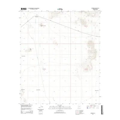
2014 Map of Hickiwan
USGS Topo · Published 2014About this map
Hickiwan sits at the northern edge of this high-desert landscape, where Bureau of Indian Affairs routes converge near the peaks of the Tohono O'odham Nation. The settlement is anchored by the proximity of Hickiwan Peak and the expansive Hickiwan Valley, which transitions southward into the Quijotoa Valley. Transport in this arid corridor relies on several key thoroughfares, including Bia-34 and Bia-17, which navigate the terrain carved by the seasonal Hickiwan Wash. To the west, the distinctive profile of Black Circle Mtn rises above the valley floor. This 2014 survey documents a territory defined by its traditional land divisions, showing the township and range boundaries of t12s r2w and t13s r1w as they intersect the natural drainages and rocky outcrops typical of the Sonoran region.
Find a feature on this map
12 named features on this map. Tap any name to fly to it.
Don’t see what you’re looking for? This feature index may not catch every label — zoom into the map to look around manually.
Map Details
Editions of this 2014 Hickiwan Map
This is the sole edition of this map. No revisions or reprints were ever made.
Other maps of this area

1953 · Ajo
USGS Topo · 1:250,000

1957 · Ajo
USGS Topo · 1:250,000

1958 · Ajo
USGS Topo · 1:250,000

1962 · Ajo
USGS Topo · 1:250,000

1963 · Ajo
USGS Topo · 1:250,000

1963 · Sikort Chuapo Mts
USGS Topo · 1:62,500

1963 · Mt. Ajo
USGS Topo · 1:62,500

1963 · Cimarron Peak
USGS Topo · 1:62,500

1963 · Pisinimo
USGS Topo · 1:62,500

1967 · Ajo
USGS Topo · 1:250,000