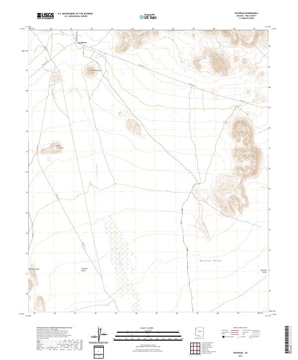
2021 Map of Hickiwan
USGS Topo · Published 2021About this map
Hickiwan sits at the northern end of this desert landscape, where the high point of Hickiwan Peak overlooks the intersection of Indian Rte 34 and Stor Pitka Rd. The terrain is defined by dramatic elevation changes, moving from the summit of Black Circle Mtn down into the broad expanse of the Quijotoa Valley and the Hickiwan Valley. These drainage basins are connected by the seasonal course of the Hickiwan Wash, which threads through the center of the survey. The transport network relies on desert routes like Indian Rte 17, which skirts the western hills. This area, within Pima County, illustrates a traditional desert settlement pattern where small communities and named peaks serve as primary landmarks across a vast, arid basin-and-range topography.
Find a feature on this map
13 named features on this map. Tap any name to fly to it.
Don’t see what you’re looking for? This feature index may not catch every label — zoom into the map to look around manually.
Map Details
Editions of this 2021 Hickiwan Map
This is the sole edition of this map. No revisions or reprints were ever made.
Other maps of this area

1953 · Ajo
USGS Topo · 1:250,000

1957 · Ajo
USGS Topo · 1:250,000

1958 · Ajo
USGS Topo · 1:250,000

1962 · Ajo
USGS Topo · 1:250,000

1963 · Ajo
USGS Topo · 1:250,000

1963 · Sikort Chuapo Mts
USGS Topo · 1:62,500

1963 · Mt. Ajo
USGS Topo · 1:62,500

1963 · Cimarron Peak
USGS Topo · 1:62,500

1963 · Pisinimo
USGS Topo · 1:62,500

1967 · Ajo
USGS Topo · 1:250,000