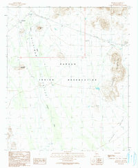
1990 Map of Hickiwan
USGS Topo · Published 1991About this map
Hickiwan lies at the northern edge of this arid landscape, situated near the base of Hickiwan Peak within the Papago Indian Reservation. The geography is defined by the broad drainage of the Hickiwan Wash as it flows south toward the Quijotoa Valley, framed by the distinct peaks of the Crooked Mountains and Black Circle Mountain.
Find a feature on this map
15 named features on this map. Tap any name to fly to it.
Don’t see what you’re looking for? This feature index may not catch every label — zoom into the map to look around manually.
Map Details
Editions of this 1990 Hickiwan Map
This is the sole edition of this map. No revisions or reprints were ever made.
Other maps of this area

1953 · Ajo
USGS Topo · 1:250,000

1957 · Ajo
USGS Topo · 1:250,000

1958 · Ajo
USGS Topo · 1:250,000

1962 · Ajo
USGS Topo · 1:250,000

1963 · Ajo
USGS Topo · 1:250,000

1963 · Sikort Chuapo Mts
USGS Topo · 1:62,500

1963 · Mt. Ajo
USGS Topo · 1:62,500

1963 · Cimarron Peak
USGS Topo · 1:62,500

1963 · Pisinimo
USGS Topo · 1:62,500

1967 · Ajo
USGS Topo · 1:250,000