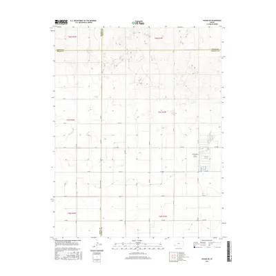
2015 Map of Hickok NE
USGS Topo · Published 2015About this map
The agricultural plains of the High Plains intersect at the shared corners of Kearny, Finney, Grant, and Haskell counties. This 2015 survey illustrates a landscape dominated by a rigorous section-line road network, including the prominent Haskell Co Line Rd and Co Rd 40. The topography is subtly marked by depressions and drainage patterns typical of Western Kansas, providing a detailed look at the rural infrastructure supporting the region's ranching and farming operations. A significant modern feature of the local economy is the Hitch Feeders II Inc. Airport, situated among the large-scale feedlot operations that define the eastern portion of Sherman Township. The map provides clear documentation of property divisions across six different townships, from t26s r35w down to t28s r34w, preserving the exact alignment of local thoroughfares like 50 Th Rd and Co Rd 80.
Find a feature on this map
26 named features on this map. Tap any name to fly to it.
Don’t see what you’re looking for? This feature index may not catch every label — zoom into the map to look around manually.
Map Details
Editions of this 2015 Hickok NE Map
This is the sole edition of this map. No revisions or reprints were ever made.
Other maps of this area

1891 · Larned
USGS Topo · 1:125,000

1896 · Garden
USGS Topo · 1:125,000

1900 · Lakin
USGS Topo · 1:125,000

1955 · Dodge City
USGS Topo · 1:250,000

1958 · Dodge City
USGS Topo · 1:250,000

1959 · Dodge City
USGS Topo · 1:250,000

1959 · Hickok NW
USGS Topo · 1:24,000

1959 · Hickok
USGS Topo · 1:24,000

1959 · Garden City 3 NW
USGS Topo · 1:24,000

1959 · Hickok NE
USGS Topo · 1:24,000