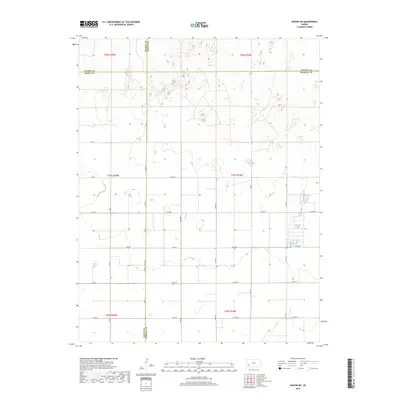
2018 Map of Hickok NE
USGS Topo · Published 2018About this map
Sherman Township and the surrounding High Plains are defined by the intersection of four counties: Grant, Haskell, Finney, and Kearny. This 2018 survey illustrates the precise, late-modern grid of section lines and gravel ways like Co Rd 80 and Co Rd 70 that organize the expansive agricultural landscape. The map reveals the systematic development of the region through the Public Land Survey System, showing the boundaries between t27s r35w and t27s r34w. The terrain is marked by subtle depressions and the absence of perennial surface water, common in this part of Kansas. A small cluster of structures and more concentrated property divisions are visible along 50 Th Rd and Co Rd 60, reflecting the contemporary rural settlement pattern where long-established county boundaries meet.
Find a feature on this map
22 named features on this map. Tap any name to fly to it.
Don’t see what you’re looking for? This feature index may not catch every label — zoom into the map to look around manually.
Map Details
Editions of this 2018 Hickok NE Map
This is the sole edition of this map. No revisions or reprints were ever made.
Other maps of this area

1891 · Larned
USGS Topo · 1:125,000

1896 · Garden
USGS Topo · 1:125,000

1900 · Lakin
USGS Topo · 1:125,000

1955 · Dodge City
USGS Topo · 1:250,000

1958 · Dodge City
USGS Topo · 1:250,000

1959 · Dodge City
USGS Topo · 1:250,000

1959 · Hickok NW
USGS Topo · 1:24,000

1959 · Hickok
USGS Topo · 1:24,000

1959 · Garden City 3 NW
USGS Topo · 1:24,000

1959 · Hickok NE
USGS Topo · 1:24,000