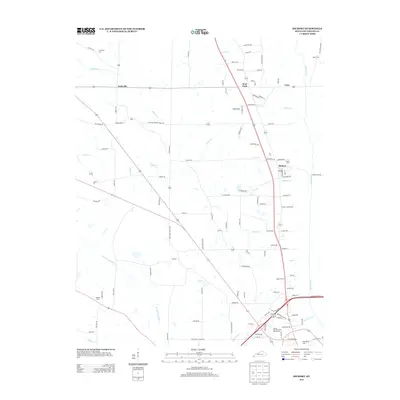
2013 Map of Hickory
USGS Topo · Published 2013About this map
The settlement of Hickory serves as a central hub in this Graves County landscape, where the local road network converges near Anderson Cr and Cooley Cr. This 2013 record illustrates the persistence of small agricultural and residential communities like Pottsville, Viola, and West Viola, which are linked by a web of rural routes and family-named thoroughfares. The drainage patterns of the Mayfield Cr and the W Fork Mayfield Cr dictate much of the local geography, with numerous smaller tributaries such as Key Cr and Gilbert Cr dissecting the terrain.
Find a feature on this map
108 named features on this map. Tap any name to fly to it.
Don’t see what you’re looking for? This feature index may not catch every label — zoom into the map to look around manually.
Map Details
Editions of this 2013 Hickory Map
This is the sole edition of this map. No revisions or reprints were ever made.
Other maps of this area

1936 · Farmington
USGS Topo · 1:24,000

1936 · Melber
USGS Topo · 1:24,000

1936 · Symsonia
USGS Topo · 1:24,000

1936 · Westplains
USGS Topo · 1:24,000

1951 · Farmington
USGS Topo · 1:24,000

1951 · Melber
USGS Topo · 1:24,000

1951 · Hickory
USGS Topo · 1:24,000
1951 · Symsonia
USGS Topo · 1:24,000
1951 · Westplains
USGS Topo · 1:24,000

1951 · Hickory
USGS Topo · 1:62,500