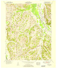
1951 Map of Westplains
USGS Topo · Published 1956About this map
The Tennessee Valley Divide snakes through this 1951 topographic study of Graves County, separating the headwaters of numerous creeks in a landscape defined by small family farms and rural congregation points. The settlement of Westplains sits near the divide, while the eastern portion of the sheet is dominated by the broad West Fork Casey Bottoms and the meandering West Fork Clarks River. This era shows a community deeply rooted in its local institutions, evidenced by the high density of country churches and family burial grounds like Shelton Chapel, Gough Cem, and Cartwright Cem.
Find a feature on this map
71 named features on this map. Tap any name to fly to it.
Don’t see what you’re looking for? This feature index may not catch every label — zoom into the map to look around manually.
Map Details
Editions of this 1951 Westplains Map
2 editions found
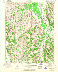
Other maps of this area

1936 · Farmington
USGS Topo · 1:24,000

1936 · Melber
USGS Topo · 1:24,000

1936 · Oak Level
USGS Topo · 1:24,000

1936 · Elva
USGS Topo · 1:24,000

1936 · Symsonia
USGS Topo · 1:24,000

1936 · Benton
USGS Topo · 1:48,000

1936 · Westplains
USGS Topo · 1:24,000

1936 · Kirksey
USGS Topo · 1:24,000

1951 · Kirksey
USGS Topo · 1:24,000

1951 · Farmington
USGS Topo · 1:24,000