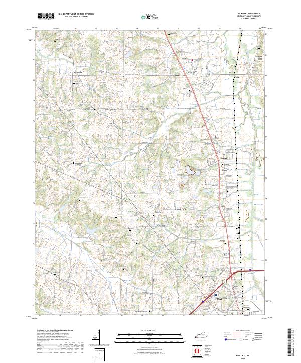
2022 Map of Hickory
USGS Topo · Published 2022About this map
Pottsville and West Viola anchor the northern reaches of this Graves County landscape, where the agricultural terrain is bisected by the Tennessee Valley Divide. The map reveals a dense network of family and community history, evidenced by numerous burial grounds including the Moore Family Cem and the Jeremiah Adams Cem. The settlement pattern follows the drainage of Wilson Creek and Gilbert Cr, with institutional landmarks like Mid-Continent University and the Hickory Amish Mennonite Church Cem providing cultural focal points.
Find a feature on this map
132 named features on this map. Tap any name to fly to it.
Don’t see what you’re looking for? This feature index may not catch every label — zoom into the map to look around manually.
Map Details
Editions of this 2022 Hickory Map
This is the sole edition of this map. No revisions or reprints were ever made.
Other maps of this area

1936 · Farmington
USGS Topo · 1:24,000

1936 · Melber
USGS Topo · 1:24,000

1936 · Symsonia
USGS Topo · 1:24,000

1936 · Westplains
USGS Topo · 1:24,000

1951 · Farmington
USGS Topo · 1:24,000

1951 · Melber
USGS Topo · 1:24,000

1951 · Hickory
USGS Topo · 1:24,000
1951 · Symsonia
USGS Topo · 1:24,000
1951 · Westplains
USGS Topo · 1:24,000

1951 · Hickory
USGS Topo · 1:62,500