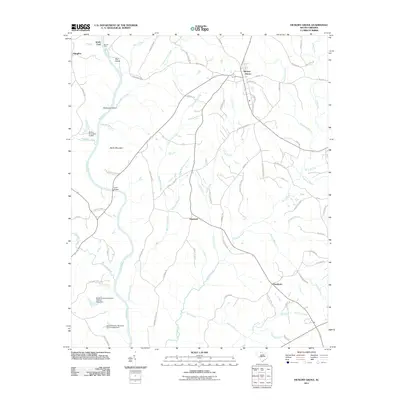
2011 Map of Hickory Grove
USGS Topo · Published 2011About this map
The Broad River carves a deep western boundary through this York County landscape, defining the character of the terrain between Worth Mountain and the water. This 2011 survey illustrates a transition from the river-bottom lands of Mud Island and McGowan Island to the higher-elevation settlements like Hickory Grove, which serves as a central hub for the local road network. The map reveals the intricate drainage patterns of the Piedmont, where Bullock Creek, Thicketty Creek, and Bells Creek weave through farm and forest land.
Find a feature on this map
74 named features on this map. Tap any name to fly to it.
Don’t see what you’re looking for? This feature index may not catch every label — zoom into the map to look around manually.
Map Details
Editions of this 2011 Hickory Grove Map
This is the sole edition of this map. No revisions or reprints were ever made.
Other maps of this area

1906 · Kings Mountain
USGS Topo · 1:62,500

1907 · Sharon
USGS Topo · 1:62,500

1908 · Kings Mountain
USGS Topo · 1:62,500

1909 · Gaffney
USGS Topo · 1:62,500

1941 · Spartanburg
USGS Topo · 1:250,000

1953 · Spartanburg
USGS Topo · 1:250,000

1953 · Charlotte
USGS Topo · 1:250,000

1954 · Charlotte
USGS Topo · 1:250,000

1960 · Charlotte
USGS Topo · 1:250,000

1960 · Spartanburg
USGS Topo · 1:250,000