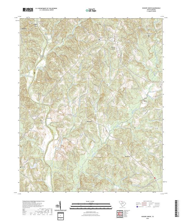
2024 Map of Hickory Grove
USGS Topo · Published 2024About this map
The Broad River serves as the prominent western boundary for this portion of the South Carolina Piedmont, where the rugged terrain of Worth Mtn rises above the surrounding creek valleys. This landscape is defined by its deep connectivity to the river, evidenced by historic crossing points such as Smiths Ford Ferry and Howells Ferry. The settlement of Hickory Grove acts as a central hub, surrounded by a network of rural communities including Hopewell, Hoodtown, and Abingdon. Local heritage is anchored by a collection of long-standing religious and burial sites, such as Unity Church, Salem Church, and Pleasant Grove Cem. The map reveals a complex drainage system where numerous tributaries, including Bullock Creek, Thickety Creek, and the aptly named Purgatory Branch, carve through the rolling hills toward the main river channel. This network of waterways and the island formations of Mud Island and McGowan Island illustrate the historical importance of the river corridor to the area's development.
Find a feature on this map
85 named features on this map. Tap any name to fly to it.
Don’t see what you’re looking for? This feature index may not catch every label — zoom into the map to look around manually.
Map Details
Editions of this 2024 Hickory Grove Map
This is the sole edition of this map. No revisions or reprints were ever made.
Other maps of this area

1906 · Kings Mountain
USGS Topo · 1:62,500

1907 · Sharon
USGS Topo · 1:62,500

1908 · Kings Mountain
USGS Topo · 1:62,500

1909 · Gaffney
USGS Topo · 1:62,500

1941 · Spartanburg
USGS Topo · 1:250,000

1953 · Spartanburg
USGS Topo · 1:250,000

1953 · Charlotte
USGS Topo · 1:250,000

1954 · Charlotte
USGS Topo · 1:250,000

1960 · Charlotte
USGS Topo · 1:250,000

1960 · Spartanburg
USGS Topo · 1:250,000