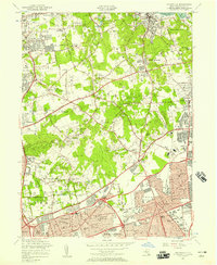
1954 Map of Hicksville
USGS Topo · Published 1957About this map
Hicksville and the surrounding villages of Oyster Bay and North Hempstead are shown here during a period of significant suburban expansion on Long Island. While the southern portion of the map is dominated by the emerging residential grids of New Cassel and Westbury, the northern hills retain a landscape of large private estates and recreational grounds. This divide is marked by the presence of numerous country clubs, such as Nassau Country Club and Piping Rock Country Club, alongside academic institutions like Long Island University.
Find a feature on this map
84 named features on this map. Tap any name to fly to it.
Don’t see what you’re looking for? This feature index may not catch every label — zoom into the map to look around manually.
Map Details
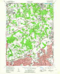
Editions of this 1954 Hicksville Map
2 editions found
Other maps of this area

1897 · Hempstead
USGS Topo · 1:62,500

1897 · Oyster Bay
USGS Topo · 1:62,500

1898 · Hempstead
USGS Topo · 1:62,500

1898 · Oyster Bay
USGS Topo · 1:62,500

1899 · Hempstead
USGS Topo · 1:62,500

1900 · Oyster Bay
USGS Topo · 1:62,500

1901 · Babylon
USGS Topo · 1:62,500

1901 · Northport
USGS Topo · 1:62,500

1903 · Babylon
USGS Topo · 1:62,500

1903 · Northport
USGS Topo · 1:62,500