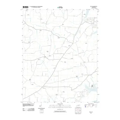
2010 Map of Hico
USGS Topo · Published 2010About this map
Jonathan Creek and its many tributaries, including Hopkins Branch and Crisp Branch, define the agricultural landscape of this Calloway County region. Small agricultural settlements like Shiloh and Faxon serve as focal points for a network of country roads, many named after the family cemeteries they lead to, such as Curd Cemetery Rd and Holland Cemetery Rd. The southeastern corner is dominated by the shoreline of Kentucky Lake, where the Irvin Cobb Resort and Buzzard Roost mark the transition from rural farming to a lakefront economy. Genealogists will find a dense concentration of burial sites, from the Jeffrey Cemetery to the Bonner Cemetery, often tucked away near stream forks or at the end of private lanes like McDay Ln.
Find a feature on this map
79 named features on this map. Tap any name to fly to it.
Don’t see what you’re looking for? This feature index may not catch every label — zoom into the map to look around manually.
Map Details
Editions of this 2010 Hico Map
This is the sole edition of this map. No revisions or reprints were ever made.
Other maps of this area

1936 · Hazel
USGS Topo · 1:24,000

1936 · New Concord
USGS Topo · 1:24,000

1936 · Hamlin
USGS Topo · 1:24,000

1936 · Fenton
USGS Topo · 1:24,000

1936 · Hardin
USGS Topo · 1:24,000

1936 · Hiatt
USGS Topo · 1:24,000

1936 · Benton
USGS Topo · 1:48,000

1936 · Golden Pond
USGS Topo · 1:48,000

1936 · Rushing
USGS Topo · 1:24,000

1936 · Dexter
USGS Topo · 1:24,000