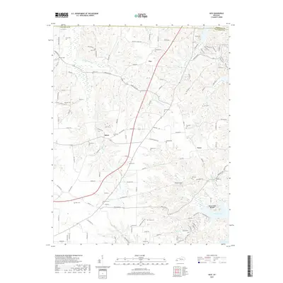
2019 Map of Hico
USGS Topo · Published 2019About this map
The rolling landscape of eastern Calloway County, Kentucky, is defined by the convergence of agricultural tradition and the expansive waters of Kentucky Lake. In this interior region, small settlements like Hico, Shiloh, and Faxon serve as focal points for a network of rural roads such as Palestine Church Rd and Green Valley Rd. The terrain is marked by numerous watercourses, including Jonathan Cr and its tributaries Little Jonathan Cr and Burr Br, which carve through the land toward the larger reservoir.
Find a feature on this map
133 named features on this map. Tap any name to fly to it.
Don’t see what you’re looking for? This feature index may not catch every label — zoom into the map to look around manually.
Map Details
Editions of this 2019 Hico Map
This is the sole edition of this map. No revisions or reprints were ever made.
Other maps of this area

1936 · Hazel
USGS Topo · 1:24,000

1936 · New Concord
USGS Topo · 1:24,000

1936 · Hamlin
USGS Topo · 1:24,000

1936 · Fenton
USGS Topo · 1:24,000

1936 · Hardin
USGS Topo · 1:24,000

1936 · Hiatt
USGS Topo · 1:24,000

1936 · Benton
USGS Topo · 1:48,000

1936 · Golden Pond
USGS Topo · 1:48,000

1936 · Rushing
USGS Topo · 1:24,000

1936 · Dexter
USGS Topo · 1:24,000