2022 Map of Hico
USGS Topo · Published 2022About this map
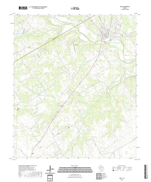
Hico sits as the primary hub in this central Texas landscape, positioned where the North Bosque River meets several local drainage systems. The town layout is clearly defined by its street grid, featuring names like Elm St and S Railroad St that hint at its development as a transit point. Genealogy researchers will find significant value in the distribution of family and community burial sites across the countryside, including the Black Family Cem and the Dry Fork Cem. The terrain is marked by numerous watercourses, such as Honey Creek and Gilmore Creek, which carve through the elevations of the Erath and Hamilton county line. Outside of the main settlement, the Putty Ranch Airport and various rural routes like Co Rd 133 demonstrate the modern agricultural and transport connectivity of the region.
Find a feature on this map
69 named features on this map. Tap any name to fly to it.
Don’t see what you’re looking for? This feature index may not catch every label — zoom into the map to look around manually.
Map Details
Editions of this 2022 Hico Map
This is the sole edition of this map. No revisions or reprints were ever made.