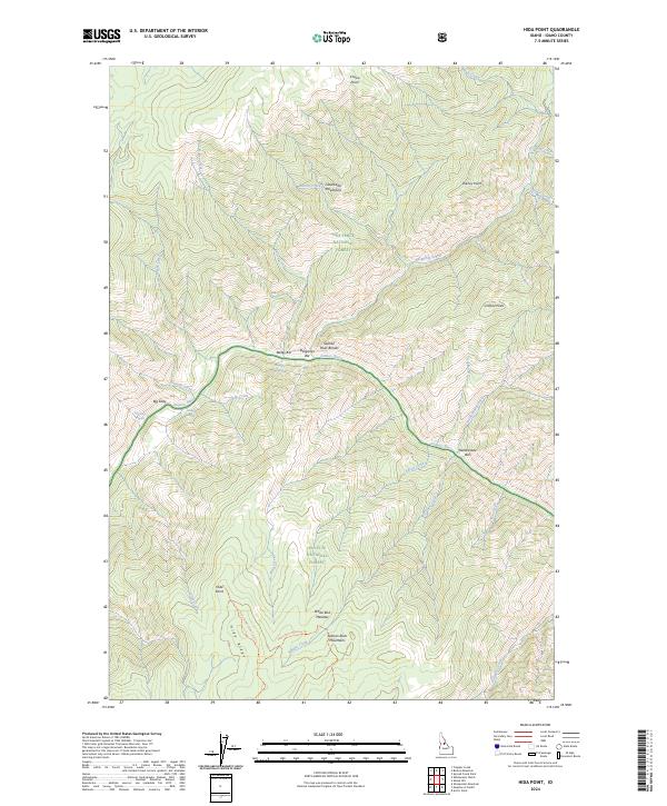
2024 Map of Hida Point
USGS Topo · Published 2024About this map
The Salmon River carves a deep path through the center of this Idaho backcountry, serving as the primary geographical divider between the Nez Perce National Forest to the north and the Payette National Forest to the south. This remote stretch of the river is characterized by numerous navigation points for river travelers, including Bargamin Rapids, Fivemile Rapids, and Split Rock Rapids. Named bars like Bailey Bar and Rattlesnake Bar sit along the riverbanks, marking the few relatively flat areas in the Salmon River Breaks.
Find a feature on this map
47 named features on this map. Tap any name to fly to it.
Don’t see what you’re looking for? This feature index may not catch every label — zoom into the map to look around manually.
Map Details
Editions of this 2024 Hida Point Map
This is the sole edition of this map. No revisions or reprints were ever made.
Other maps of this area

1956 · Elk City
USGS Topo · 1:250,000

1960 · Elk City
USGS Topo · 1:250,000

1974 · Meadow Of Doubt
USGS Topo · 1:24,000

1977 · Boston Mtn
USGS Topo · 1:24,000

1978 · Arctic Point
USGS Topo · 1:24,000

1978 · Spread Creek Point
USGS Topo · 1:24,000

1978 · Hida Point
USGS Topo · 1:24,000

1978 · Sheep Hill
USGS Topo · 1:24,000

1978 · Trapper Creek
USGS Topo · 1:24,000
1979 · Whitewater Ranch
USGS Topo · 1:24,000