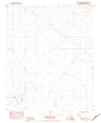
1984 Map of Hidden Hills Ranch
USGS Topo · Published 1984About this map
Hidden Hills Ranch stands as the primary hub of activity in this high-desert landscape during the mid-1980s. The map illustrates a transition from traditional land uses like mining and ranching toward modern infrastructure, evidenced by the presence of the Hidden Hills Landing Strip and the sprawling Double Wooden Pole Transmission Line cutting across the terrain. Historical resource extraction is marked by the Green Monster Mine, while natural landmarks like Cathedral Canyon and Stump Spring anchor the topography. This provisional survey provides a clear view of the sparse settlement patterns and utilitarian developments in Clark County just before the area's later transformations.
Find a feature on this map
9 named features on this map. Tap any name to fly to it.
Don’t see what you’re looking for? This feature index may not catch every label — zoom into the map to look around manually.
Map Details
Editions of this 1984 Hidden Hills Ranch Map
This is the sole edition of this map. No revisions or reprints were ever made.
Other maps of this area

1907 · Las Vegas
USGS Topo · 1:250,000

1908 · Las Vegas
USGS Topo · 1:250,000

1910 · Ivanpah
USGS Topo · 1:250,000

1912 · Ivanpah
USGS Topo · 1:250,000

1942 · Ivanpah
USGS Topo · 1:250,000

1947 · Kingman
USGS Topo · 1:250,000

1948 · Kingman
USGS Topo · 1:250,000

1954 · Las Vegas
USGS Topo · 1:250,000

1954 · Kingman
USGS Topo · 1:250,000

1955 · Kingman
USGS Topo · 1:250,000