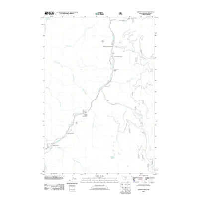
2011 Map of Hidden Lakes
USGS Topo · Published 2011About this map
The Gallatin River corridor serves as the central artery for this Montana landscape, where the legacy of early ranching and industrial extraction remains visible through named landmarks. The Karst Ranch and the Karst Asbestos Mine reflect the localized influence of the Karst family on the region's development during the early 20th century. Numerous bridges, including the Gallatin Golden Gate Bridge, Jack Smith Bridge, and Anceney Bridge, facilitate movement across the river, connecting forest roads like Wild Flower Way and Portal Creek Rd to the surrounding highlands.
Find a feature on this map
30 named features on this map. Tap any name to fly to it.
Don’t see what you’re looking for? This feature index may not catch every label — zoom into the map to look around manually.
Map Details
Editions of this 2011 Hidden Lakes Map
This is the sole edition of this map. No revisions or reprints were ever made.
Other maps of this area

1888 · Three Forks
USGS Topo · 1:250,000

1894 · Three Forks
USGS Topo · 1:250,000

1895 · Three Forks
USGS Topo · 1:250,000

1947 · Bozeman
USGS Topo · 1:250,000

1948 · Bozeman
USGS Topo · 1:250,000

1950 · Spanish Peaks
USGS Topo · 1:62,500

1950 · Sphinx Mountain
USGS Topo · 1:62,500

1955 · Bozeman
USGS Topo · 1:250,000

1955 · Garnet Mountain
USGS Topo · 1:62,500

1955 · Crown Butte
USGS Topo · 1:62,500