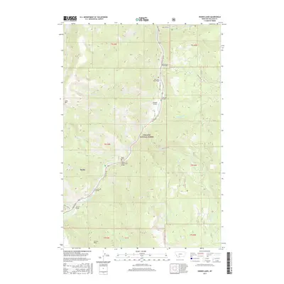
2017 Map of Hidden Lakes
USGS Topo · Published 2017About this map
Gallatin National Forest encompasses the majority of this mountain landscape, where the Gallatin River carves through the prominent Gallatin Canyon. The presence of numerous named crossings along Gallatin Rd, including the Gallatin Golden Gate Bridge, Jack Smith Bridge, and Anceney Bridge, indicates the importance of this corridor for accessing the high-elevation backcountry. To the west, Table Mtn rises above the drainage of Cascade Cr and Lava Lake, while the southern reaches of the quadrangle feature the developed area of Big Sky and the nearby Levinski Ridge. The drainage network is dense with tributaries such as Moose Cr, Swan Cr, and Portal Cr, the latter of which leads toward the remote Hidden Lakes in the southeastern corner of the survey.
Find a feature on this map
38 named features on this map. Tap any name to fly to it.
Don’t see what you’re looking for? This feature index may not catch every label — zoom into the map to look around manually.
Map Details
Editions of this 2017 Hidden Lakes Map
This is the sole edition of this map. No revisions or reprints were ever made.
Other maps of this area
1888 · Three Forks
USGS Topo · 1:250,000
1894 · Three Forks
USGS Topo · 1:250,000
1895 · Three Forks
USGS Topo · 1:250,000

1947 · Bozeman
USGS Topo · 1:250,000

1948 · Bozeman
USGS Topo · 1:250,000
1950 · Spanish Peaks
USGS Topo · 1:62,500
1950 · Sphinx Mountain
USGS Topo · 1:62,500
1955 · Bozeman
USGS Topo · 1:250,000
1955 · Garnet Mountain
USGS Topo · 1:62,500
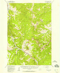
1955 · Crown Butte
USGS Topo · 1:62,500