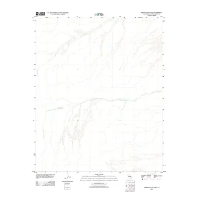
2012 Map of Hidden Valley East
USGS Topo · Published 2012About this map
Hidden Valley and the surrounding high desert terrain define this corner of San Bernardino County in the early 21st century. The landscape is characterized by intermittent drainage systems, notably Baxter Wash and the winding Hidden Valley Wash, which trace the path of seasonal water flow through the arid environment. These topographical features represent the primary structural elements of the area, illustrating the natural hydrological patterns of the Mojave Desert. Sparse infrastructure and the dominance of the natural terrain underscore the remote character of this region as it was surveyed in 2012.
Find a feature on this map
3 named features on this map. Tap any name to fly to it.
Don’t see what you’re looking for? This feature index may not catch every label — zoom into the map to look around manually.
Map Details
Editions of this 2012 Hidden Valley East Map
This is the sole edition of this map. No revisions or reprints were ever made.
Other maps of this area

1933 · Avawatz Mountains
USGS Topo · 1:250,000

1947 · Trona
USGS Topo · 1:250,000

1948 · Trona
USGS Topo · 1:250,000
1948 · Cave Mountain
USGS Topo · 1:62,500
1951 · Cave Mountain
USGS Topo · 1:62,500
1953 · San Bernardino
USGS Topo · 1:250,000

1953 · Trona
USGS Topo · 1:250,000
1955 · Cady Mountains
USGS Topo · 1:62,500
1955 · Broadwell Lake
USGS Topo · 1:62,500
1956 · San Bernardino
USGS Topo · 1:250,000