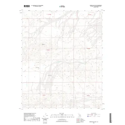
2018 Map of Hidden Valley East
USGS Topo · Published 2018About this map
Cady Mountains rise over the high desert landscape, anchoring this section of the Mojave Desert in San Bernardino County. The topography is defined by seasonal drainage systems, most notably the wide paths of Baxter Wash and Hidden Valley Wash, which indicate the powerful alluvial processes shaping the region's basin-and-range profile. Within this arid expanse lies the namesake Hidden Valley, an area where the complex desert terrain forms a natural depression between the surrounding uplands. The U.S. Geological Survey topographic data reveals a land primarily defined by its natural features and drainage patterns, with the Public Land Survey System grids marking out the township and range lines across the uninhabited desert floor.
Find a feature on this map
11 named features on this map. Tap any name to fly to it.
Don’t see what you’re looking for? This feature index may not catch every label — zoom into the map to look around manually.
Map Details
Editions of this 2018 Hidden Valley East Map
This is the sole edition of this map. No revisions or reprints were ever made.
Other maps of this area

1933 · Avawatz Mountains
USGS Topo · 1:250,000

1947 · Trona
USGS Topo · 1:250,000

1948 · Trona
USGS Topo · 1:250,000
1948 · Cave Mountain
USGS Topo · 1:62,500
1951 · Cave Mountain
USGS Topo · 1:62,500
1953 · San Bernardino
USGS Topo · 1:250,000

1953 · Trona
USGS Topo · 1:250,000
1955 · Cady Mountains
USGS Topo · 1:62,500
1955 · Broadwell Lake
USGS Topo · 1:62,500
1956 · San Bernardino
USGS Topo · 1:250,000