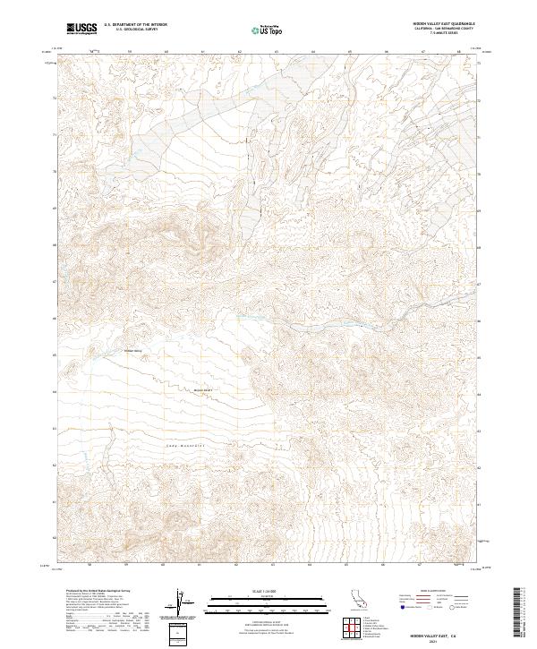
2021 Map of Hidden Valley East
USGS Topo · Published 2021About this map
Cady Mountains dominate the southern portion of this desert landscape, where steep contours give way to the broad alluvial plains of the Mojave Desert. This arid region in San Bernardino County is defined by its complex drainage systems, notably Hidden Valley Wash and Baxter Wash, which reveal the natural pathways of seasonal runoff through the shifting sands and rocky outcrops. The map illustrates a largely unsettled expanse, focusing on the natural geography of Hidden Valley and the surrounding mountain slopes. The lack of human structures or modern development in this area highlights the persistent wilderness character of the California desert, where township and range lines like t10n r6e serve as the primary markers for navigation across the open terrain.
Find a feature on this map
11 named features on this map. Tap any name to fly to it.
Don’t see what you’re looking for? This feature index may not catch every label — zoom into the map to look around manually.
Map Details
Editions of this 2021 Hidden Valley East Map
This is the sole edition of this map. No revisions or reprints were ever made.
Other maps of this area

1933 · Avawatz Mountains
USGS Topo · 1:250,000

1947 · Trona
USGS Topo · 1:250,000

1948 · Trona
USGS Topo · 1:250,000

1948 · Cave Mountain
USGS Topo · 1:62,500

1951 · Cave Mountain
USGS Topo · 1:62,500

1953 · San Bernardino
USGS Topo · 1:250,000

1953 · Trona
USGS Topo · 1:250,000

1955 · Cady Mountains
USGS Topo · 1:62,500

1955 · Broadwell Lake
USGS Topo · 1:62,500

1956 · San Bernardino
USGS Topo · 1:250,000