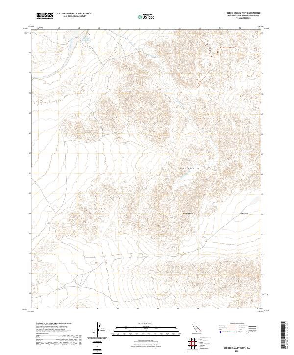
2021 Map of Hidden Valley West
USGS Topo · Published 2021About this map
The Cady Mountains dominate this section of the Mojave Desert, rising over a landscape defined by seasonal watercourses and high-altitude basins. Central to the topography is Hidden Valley, a secluded pocket east of the primary peaks. In a region where permanent water is scarce, the presence of Ninemile Waterhole in the northwest corner and the path of the Mojave River indicate critical environmental landmarks for early desert navigation.
Find a feature on this map
13 named features on this map. Tap any name to fly to it.
Don’t see what you’re looking for? This feature index may not catch every label — zoom into the map to look around manually.
Map Details
Editions of this 2021 Hidden Valley West Map
This is the sole edition of this map. No revisions or reprints were ever made.
Other maps of this area

1933 · Avawatz Mountains
USGS Topo · 1:250,000

1947 · Trona
USGS Topo · 1:250,000

1948 · Trona
USGS Topo · 1:250,000

1948 · Alvord Mountain
USGS Topo · 1:62,500

1948 · Cave Mountain
USGS Topo · 1:62,500

1951 · Cave Mountain
USGS Topo · 1:62,500

1951 · Alvord Mountain
USGS Topo · 1:62,500

1953 · San Bernardino
USGS Topo · 1:250,000

1953 · Trona
USGS Topo · 1:250,000

1955 · Newberry
USGS Topo · 1:62,500