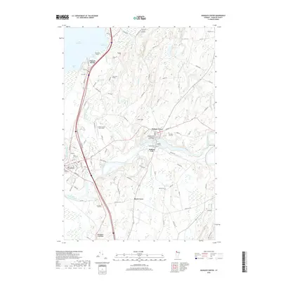
2018 Map of Highgate Center
USGS Topo · Published 2018About this map
Highgate Center and the neighboring settlements of Highgate Falls and Highgate Springs define this corner of Franklin County along the Canadian border. The landscape is deeply tied to its water features, where the Missisquoi River bends sharply through the southern reaches and the Rock River flows into Lake Champlain via Rock River Bay. A striking density of burial sites, including Saint Marys Cem and the New Saint Louis Cem, provides a detailed record of the local community's history and genealogy.
Find a feature on this map
101 named features on this map. Tap any name to fly to it.
Don’t see what you’re looking for? This feature index may not catch every label — zoom into the map to look around manually.
Map Details
Editions of this 2018 Highgate Center Map
This is the sole edition of this map. No revisions or reprints were ever made.
Other maps of this area

1914 · St. Albans
USGS Topo · 1:48,000

1916 · St. Albans
USGS Topo · 1:62,500

1920 · Franklin Pond
USGS Topo · 1:62,500

1922 · Enosburg Falls
USGS Topo · 1:48,000

1924 · Enosburg Falls
USGS Topo · 1:62,500

1943 · St. Albans
USGS Topo · 1:62,500

1944 · Enosburg Falls
USGS Topo · 1:62,500

1950 · Lake Champlain
USGS Topo · 1:250,000
1953 · Enosburg Falls
USGS Topo · 1:62,500

1958 · Lake Champlain
USGS Topo · 1:250,000