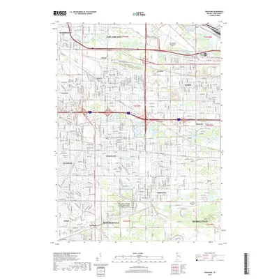
2019 Map of Highland
USGS Topo · Published 2019About this map
The Grand Calumet River and Little Calumet River define the industrial and residential corridors of Northwest Indiana in this 2019 survey. The map shows a high concentration of religious burial grounds including Saint John Saint Joseph Catholic Cem and Saint Nicholas Cem, reflecting the deep-rooted immigrant and community history of Hammond and Gary. Transportation remains a central theme, as modern rail infrastructure like the Gibson Transfer Rd intersects with a growing network of recreational paths, such as the Erie Lackawanna / Cross Town Trail and the Yellow Connector Trail. This document reveals the transition from heavy rail and industrial use toward public spaces, including the northern portions of Indiana Dunes National Park near Griffith and Merrillville.
Find a feature on this map
61 named features on this map. Tap any name to fly to it.
Don’t see what you’re looking for? This feature index may not catch every label — zoom into the map to look around manually.
Map Details
Editions of this 2019 Highland Map
This is the sole edition of this map. No revisions or reprints were ever made.
Other maps of this area

1892 · Calumet
USGS Topo · 1:62,500

1893 · Calumet
USGS Topo · 1:62,500

1900 · Toleston
USGS Topo · 1:62,500

1900 · Calumet
USGS Topo · 1:62,500

1901 · Calumet
USGS Topo · 1:62,500

1929 · Calumet Lake
USGS Topo · 1:24,000

1929 · Calumet City
USGS Topo · 1:24,000

1929 · Dyer
USGS Topo · 1:24,000

1930 · Dyer
USGS Topo · 1:24,000

1949 · Crete
USGS Topo · 1:62,500