
1929 Map of Calumet Lake
USGS Topo · Published 1929About this map
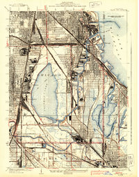
Calumet Lake and its industrial surroundings define this late-1920s landscape on the Illinois-Indiana border. The map reveals the intricate urban and industrial fabric of Pullman, Kensington, and Hegewisch, where the Pullman R R and Illinois Central railroads intersect with the Calumet River system. The proximity of the Pullman Training School and the Brickyard near the Little Calumet River highlights the era's focus on specialized education and local manufacturing. To the east, the undeveloped areas around Wolf Lake and Lake George stand in contrast to the dense residential and commercial blocks of South Chicago and East Side. The heavy concentration of rail lines, including the Indiana Harbor Belt and the Belt Ry of Chicago, underscores the region's role as a primary transportation hub for the Midwest, connecting the factories of Hammond and Dolton to the wider shipping lanes of Lake Michigan.
Find a feature on this map
41 named features on this map. Tap any name to fly to it.
Don’t see what you’re looking for? This feature index may not catch every label — zoom into the map to look around manually.
Map Details
Editions of this 1929 Calumet Lake Map
3 editions found
Other maps of this area

1889 · Chicago
USGS Topo · 1:62,500

1891 · Chicago
USGS Topo · 1:62,500

1892 · Calumet
USGS Topo · 1:62,500

1893 · Calumet
USGS Topo · 1:62,500

1900 · Chicago
USGS Topo · 1:62,500

1900 · Toleston
USGS Topo · 1:62,500

1900 · Calumet
USGS Topo · 1:62,500

1901 · Calumet
USGS Topo · 1:62,500

1901 · Chicago
USGS Topo · 1:62,500

1929 · Calumet City
USGS Topo · 1:24,000