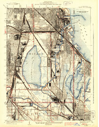
1929 Map of Calumet Lake
USGS Topo · Published 1939About this map
Industrial and residential development defines this landscape during the late 1920s and 1930s as the Chicago city boundary meets the Illinois Indiana state line. The sprawling waters of Calumet Lake and Wolf Lake dominate the geography, flanked by a complex grid of streets and rail yards. The company town of Pullman stands prominently on the western shore of the lake, near the Pullman Training School, while neighborhoods like South Deering, Hegewisch, and Robertsdale occupy the low-lying land between the heavy rail corridors.
Find a feature on this map
71 named features on this map. Tap any name to fly to it.
Don’t see what you’re looking for? This feature index may not catch every label — zoom into the map to look around manually.
Map Details
Editions of this 1929 Calumet Lake Map
3 editions found
Other maps of this area

1889 · Chicago
USGS Topo · 1:62,500

1891 · Chicago
USGS Topo · 1:62,500

1892 · Calumet
USGS Topo · 1:62,500

1893 · Calumet
USGS Topo · 1:62,500

1900 · Chicago
USGS Topo · 1:62,500

1900 · Toleston
USGS Topo · 1:62,500

1900 · Calumet
USGS Topo · 1:62,500

1901 · Calumet
USGS Topo · 1:62,500

1901 · Chicago
USGS Topo · 1:62,500

1929 · Calumet Lake
USGS Topo · 1:24,000