
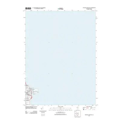
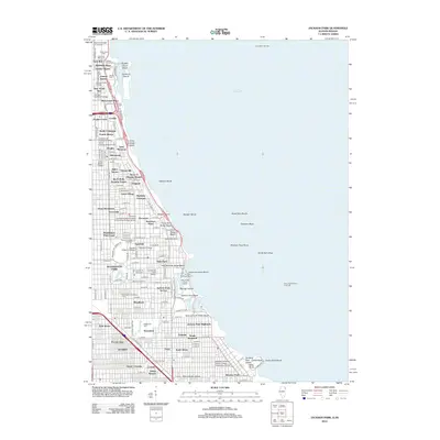
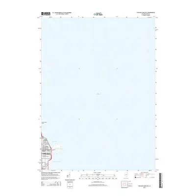
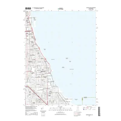
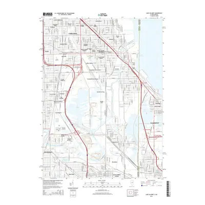
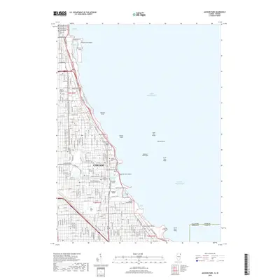
1893 Map of Calumet
USGS Topo · Published 1893About this map
Industrial expansion and rail networks dominate this late 19th-century landscape south of Chicago, where marshy lowlands meet the growing urban grid. The planned industrial community of Pullman sits along the western shore of Calumet Lake, reflecting the era’s ambitious corporate-led development. To the east, South Chicago serves as a gateway to Lake Michigan, while a complex web of railroads including the Illinois Central Railroad and Chicago Rock Island and Pacific Railroad converge near Blue Island.
Find a feature on this map
53 named features on this map. Tap any name to fly to it.
Don’t see what you’re looking for? This feature index may not catch every label — zoom into the map to look around manually.
Map Details
Editions of this 1893 Calumet Map
This is the sole edition of this map. No revisions or reprints were ever made.
Historical Maps of Chicago Through Time
60 maps found

1892 Calumet
Cook County, IL
1893 Calumet
Cook County, IL

1900 Calumet
Cook County, IL

1901 Calumet
Cook County, IL

1928 Sag Bridge
Cook County, IL

1929 Calumet Lake
Cook County, IL

1929 Chicago Loop
Cook County, IL

1929 Englewood
Cook County, IL

1929 Jackson Park
Cook County, IL

1953 Calumet Lake
Cook County, IL

1953 Chicago Loop
Cook County, IL

1953 Englewood
Cook County, IL

1953 Jackson Park
Cook County, IL

1953 Sag Bridge
Cook County, IL

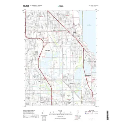
1960 Lake Calumet
Cook County, IL

1963 Chicago Loop
Cook County, IL

1963 Englewood
Cook County, IL

1963 Jackson Park
Cook County, IL

1963 Sag Bridge
Cook County, IL

1965 Lake Calumet
Cook County, IL

1991 Lake Calumet
Cook County, IL

1993 Chicago Loop
Cook County, IL

1993 Englewood
Cook County, IL

1993 Jackson Park
Cook County, IL

1993 Sag Bridge
Cook County, IL

1997 Chicago Loop
Cook County, IL

1997 Englewood
Cook County, IL

1997 Lake Calumet
Cook County, IL

1997 Sag Bridge
Cook County, IL

1998 Jackson Park
Cook County, IL

2012 Chicago Loop
Cook County, IL
2012 Chicago Loop OE E
Cook County, IL

2012 Englewood
Cook County, IL
2012 Jackson Park
Cook County, IL

2012 Lake Calumet
Cook County, IL

2012 Sag Bridge
Cook County, IL

2015 Chicago Loop
Cook County, IL
2015 Chicago Loop OE E
Cook County, IL

2015 Englewood
Cook County, IL
2015 Jackson Park
Cook County, IL
2015 Lake Calumet
Cook County, IL
2015 Sag Bridge
Cook County, IL

2018 Chicago Loop
Cook County, IL
2018 Chicago Loop OE E
Cook County, IL
2018 Englewood
Cook County, IL
2018 Jackson Park
Cook County, IL
2018 Lake Calumet
Cook County, IL
2018 Sag Bridge
Cook County, IL

2021 Chicago Loop
Cook County, IL

2021 Chicago Loop OE E
Cook County, IL

2021 Englewood
Cook County, IL

2021 Jackson Park
Cook County, IL

2021 Lake Calumet
Cook County, IL
2021 Sag Bridge
Cook County, IL

2024 Chicago Loop
Cook County, IL

2024 Chicago Loop OE E
Cook County, IL

2024 Englewood
Cook County, IL

2024 Jackson Park
Cook County, IL

2024 Lake Calumet
Cook County, IL

2024 Sag Bridge
Cook County, IL
Featured Locations
- Chicago, IL
- Oak Lawn, Worth Township
- Hammond, North Township
- Calumet City, Thornton Township
- Burbank, Stickney Township