
Loading...
Loading map...1900 Map of Riverside
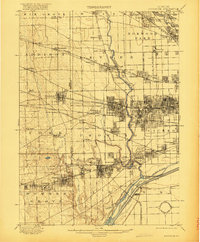
USGS Topo · Published 1900About this map
The Desplaines River valley west of Chicago serves as a massive corridor for transportation and infrastructure at the turn of the century. Large-scale civil engineering projects dominate the southern landscape, most notably the Chicago Sanitary and Ship Canal and the Chicago Diversion Channel running parallel to the Old Channel. These massive waterways cut through the landscape near Summit and Mc Cook, redirecting the region's hydrology.
Find a feature on this map
88 named features on this map. Tap any name to fly to it.
Don’t see what you’re looking for? This feature index may not catch every label — zoom into the map to look around manually.
Map Details
Date Portrayed1900
Date Published1900
PublisherU.S. Geological Survey
Map TypeTopographic
Scale1:62,500
Physical Dimensions15.9 x 19.9 inches
Editions of this 1900 Riverside Map
This is the sole edition of this map. No revisions or reprints were ever made.
Historical Maps of Chicago Through Time
4 maps found


Featured Locations
Source Details
SourceU.S. Geological Survey
CopyrightPublic Domain