
1899 Map of Evanston
USGS Topo · Published 1899About this map
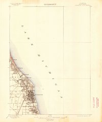
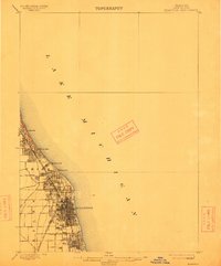
Evanston serves as the focal point of this 1897 survey, showing the intensive urban grid of the lakefront community just before the turn of the century. The shoreline of Lake Michigan dominates the eastern half of the sheet, dictating the development of the north shore suburbs. The Chicago and Northwestern railroad corridor acts as the primary spine of the region, linking the township of New Trier and the village of Winnetka directly to the burgeoning metropolis to the south.
Find a feature on this map
12 named features on this map. Tap any name to fly to it.
Don’t see what you’re looking for? This feature index may not catch every label — zoom into the map to look around manually.
Map Details
Editions of this 1899 Evanston Map
3 editions found
Other maps of this area

1889 · Chicago
USGS Topo · 1:62,500

1891 · Chicago
USGS Topo · 1:62,500

1891 · Riverside
USGS Topo · 1:62,500

1893 · Riverside
USGS Topo · 1:62,500

1900 · Chicago
USGS Topo · 1:62,500

1900 · Riverside
USGS Topo · 1:62,500

1900 · Highwood
USGS Topo · 1:62,500

1901 · Riverside
USGS Topo · 1:62,500

1901 · Chicago
USGS Topo · 1:62,500

1906 · Waukegan
USGS Topo · 1:62,500