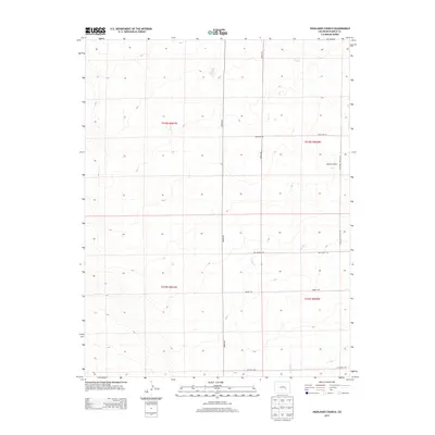
2013 Map of Highlands Church
USGS Topo · Published 2013About this map
Highlands Church stands as the central landmark in this portion of Pueblo County, situated along Highland Church Rd in a landscape defined by its grid-patterned rural road system. This high-plains terrain is etched by the drainage of Kramer Cr, which winds through the eastern sections of the quadrangle. The map documents the persistent agricultural and ranching layout of the early 21st century, with major thoroughfares like Edison Rd and Highland Rd facilitating movement between scattered holdings. Notable local naming conventions are preserved through labels such as Mrs Wright Rd and Hodges Rd, offering clear markers for property research and local genealogy. The underlying survey framework, including t018s r060w and t019s r061w, provides a precise reference for land ownership and historical boundaries in this rural Colorado corridor.
Find a feature on this map
12 named features on this map. Tap any name to fly to it.
Don’t see what you’re looking for? This feature index may not catch every label — zoom into the map to look around manually.
Map Details
Editions of this 2013 Highlands Church Map
This is the sole edition of this map. No revisions or reprints were ever made.
Other maps of this area
1891 · Nepesta
USGS Topo · 1:125,000
1893 · Nepesta
USGS Topo · 1:125,000
1893 · Big Springs
USGS Topo · 1:125,000
1904 · Nepesta
USGS Topo · 1:125,000
1954 · Pueblo
USGS Topo · 1:250,000
1957 · Pueblo
USGS Topo · 1:250,000
1958 · Pueblo
USGS Topo · 1:250,000
1959 · Highlands Church
USGS Topo · 1:24,000
1959 · Grandview School
USGS Topo · 1:24,000
1959 · North Avondale NE
USGS Topo · 1:24,000