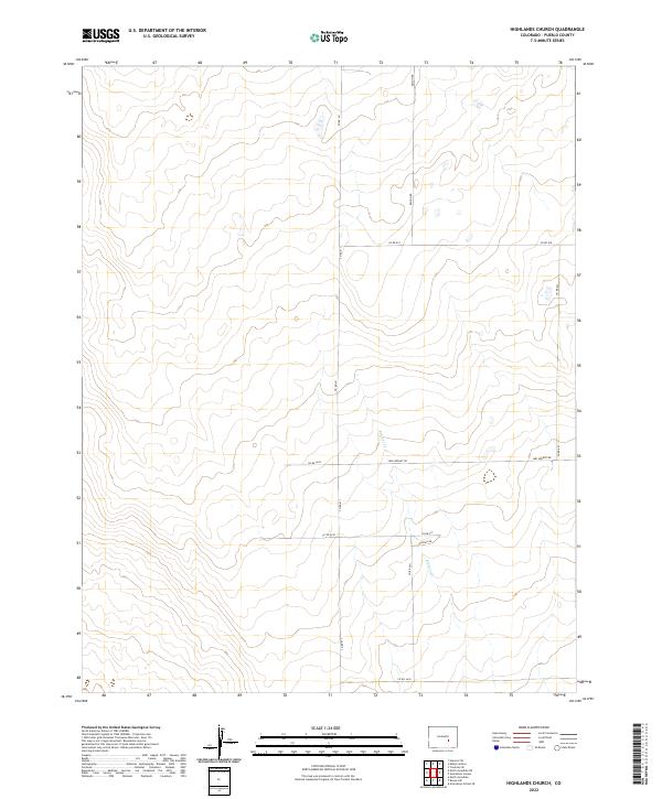
2022 Map of Highlands Church
USGS Topo · Published 2022About this map
Kramer Cr defines the subtle drainage patterns of this high plains landscape in eastern Pueblo County. The terrain is structured by a grid of rural county routes and section lines, including Edison Rd and Co Rd 611. Named paths such as Mrs Wright Rd and Hodges Rd suggest the enduring presence of family-held lands and ranching history in this part of Colorado. While the map is sparse in terms of dense settlements, it provides a precise look at the land partitions under the Public Land Survey System, specifically across the intersections of t18s r61w and t19s r60w. This contemporary record is an essential resource for those tracing land ownership and the evolution of rural road networks in the semi-arid grasslands.
Find a feature on this map
16 named features on this map. Tap any name to fly to it.
Don’t see what you’re looking for? This feature index may not catch every label — zoom into the map to look around manually.
Map Details
Editions of this 2022 Highlands Church Map
This is the sole edition of this map. No revisions or reprints were ever made.
Other maps of this area

1891 · Nepesta
USGS Topo · 1:125,000

1893 · Nepesta
USGS Topo · 1:125,000

1893 · Big Springs
USGS Topo · 1:125,000

1904 · Nepesta
USGS Topo · 1:125,000

1954 · Pueblo
USGS Topo · 1:250,000

1957 · Pueblo
USGS Topo · 1:250,000

1958 · Pueblo
USGS Topo · 1:250,000

1959 · Highlands Church
USGS Topo · 1:24,000
1959 · Grandview School
USGS Topo · 1:24,000

1959 · North Avondale NE
USGS Topo · 1:24,000