2022 Map of Highlands
USGS Topo · Published 2022About this map
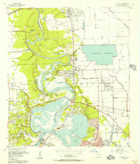
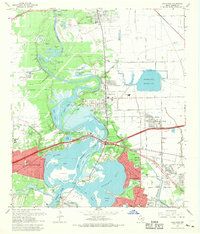
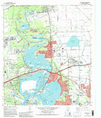
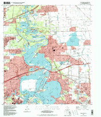
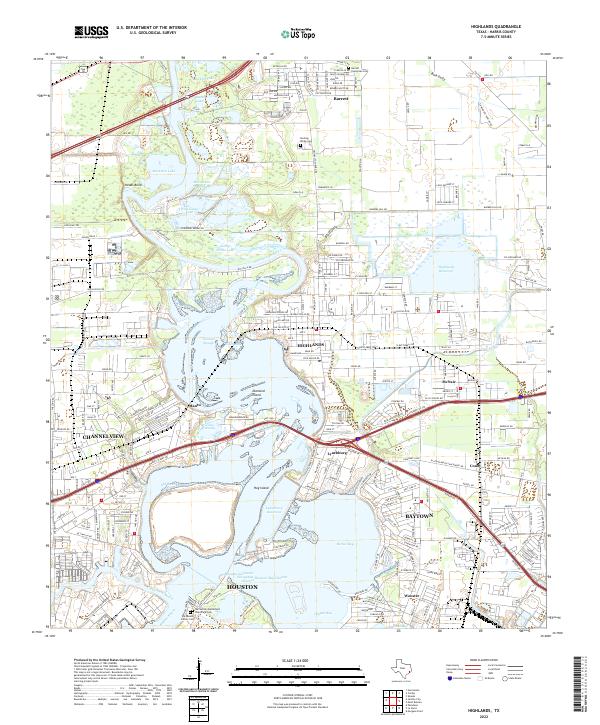
The San Jacinto River and its complex network of sloughs and bayous define this coastal landscape, where the Houston Ship Channel meets the historic waters of Burnet Bay and Crystal Bay. The map highlights a significant intersection of Texas history and modern industry, featuring the San Jacinto Battlefield State Park Cem and the De Zavala Family Cem near the southern banks. Industrial and residential development is concentrated around Highlands, Lynchburg, and McNair, with the massive Highlands Reservoir and Lynchburg Reservoir serving as prominent man-made landmarks. To the north, the river meanders through several oxbow lakes including Muleshoe Lake and McCracken Lake, illustrating the evolving hydrology of the region near the community of Barrett.
Find a feature on this map
56 named features on this map. Tap any name to fly to it.
Don’t see what you’re looking for? This feature index may not catch every label — zoom into the map to look around manually.
Map Details
Editions of this 2022 Highlands Map
This is the sole edition of this map. No revisions or reprints were ever made.
Historical Maps of McNair Through Time
5 maps found