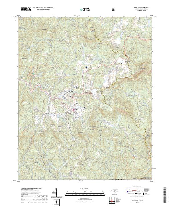
2022 Map of Highlands
USGS Topo · Published 2022About this map
The town of Highlands occupies a high-altitude plateau where the Tennessee Valley Divide snakes across the terrain, separating waters destined for the Gulf of Mexico from those flowing toward the Atlantic. This 2022 survey detail shows a community deeply integrated with the Nantahala National Forest, where steep vertical drops create a concentration of landmarks including Bridal Veil Falls, Dry Falls, and Satulah Falls. The landscape is defined by massive granite features like Whiteside Mtn and the Chattooga Cliffs, while local history is anchored at the Highlands Memorial Park Cem and the more remote Horse Cove Cem. Notable water bodies such as Ravenel Lake and Whiteside Lake reflect the area’s long-standing development as a mountain retreat, with modern road networks like Franklin Rd and Walhalla Rd tracing the same difficult geography once navigated by early settlers.
Find a feature on this map
167 named features on this map. Tap any name to fly to it.
Don’t see what you’re looking for? This feature index may not catch every label — zoom into the map to look around manually.
Map Details
Editions of this 2022 Highlands Map
This is the sole edition of this map. No revisions or reprints were ever made.
Other maps of this area

1886 · Walhalla
USGS Topo · 1:125,000

1891 · Cowee
USGS Topo · 1:125,000

1892 · Walhalla
USGS Topo · 1:125,000

1896 · Walhalla
USGS Topo · 1:125,000

1897 · Cowee
USGS Topo · 1:125,000

1907 · Cowee
USGS Topo · 1:125,000

1935 · Cashiers
USGS Topo · 1:24,000

1935 · Scaly
USGS Topo · 1:24,000

1935 · Rabun Bald
USGS Topo · 1:24,000

1935 · Glenville
USGS Topo · 1:24,000