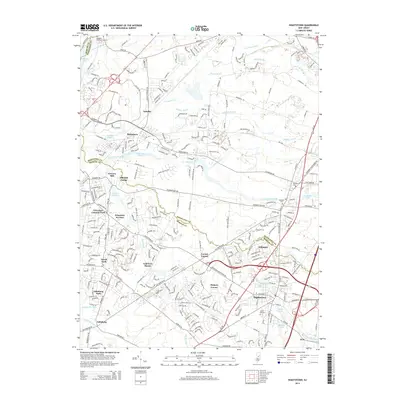
2014 Map of Hightstown
USGS Topo · Published 2014About this map
Hightstown and Plainsboro anchor this 2014 survey, which highlights the dense residential development and suburban growth along the Middlesex Co and Mercer Co border. The landscape is defined by its sophisticated water management and drainage, with numerous brooks such as Devils Brook, Shallow Brook, and Cranbury Brook feeding into the Millstone River and Assunpink Creek. The map records several smaller historical nodes like Schalks, Grovers Mill, and Locust Corner, alongside larger residential areas like Princeton Ivy East and Golf View Manor. Notable for genealogists and local historians are several long-established burial grounds, including the Kingston Presbyterian Cem in the northwest and Brainerd Cem near the center of the quadrangle. Significant recreational and hydrological features like Carnegie Lake, Grovers Mill Pond, and Etra Lake illustrate how the region's natural waterways have been harnessed for both local industry and community utility.
Find a feature on this map
275 named features on this map. Tap any name to fly to it.
Don’t see what you’re looking for? This feature index may not catch every label — zoom into the map to look around manually.
Map Details
Editions of this 2014 Hightstown Map
This is the sole edition of this map. No revisions or reprints were ever made.
Other maps of this area

1888 · Bordentown
USGS Topo · 1:62,500

1888 · New Brunswick
USGS Topo · 1:62,500

1888 · Princeton
USGS Topo · 1:62,500

1888 · Cassville
USGS Topo · 1:62,500

1893 · Bordentown
USGS Topo · 1:62,500

1893 · New Brunswick
USGS Topo · 1:62,500

1894 · Princeton
USGS Topo · 1:62,500

1894 · Cassville
USGS Topo · 1:62,500

1900 · Cassville
USGS Topo · 1:62,500

1901 · New Brunswick
USGS Topo · 1:62,500
Featured Places
- Franklin Township, NJ
- South Brunswick, NJ
- East Windsor Township, NJ
- West Windsor, NJ
- Plainsboro Township, NJ