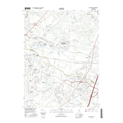
2016 Map of Hightstown
USGS Topo · Published 2016About this map
Hightstown serves as a focal point for this Central New Jersey corridor, where the historic borough sits at the confluence of Rocky Brook and the Millstone River. The landscape is defined by its water-powered history, evident in sites like Grovers Mill and the presence of several established reservoirs including Peddie Lake and Brainerd Lake. Modern suburban development patterns around Plainsboro Center, Princeton Meadows, and Cranbury are clearly delineated against the surviving stream valleys of Devils Brook and Shallow Brook.
Find a feature on this map
58 named features on this map. Tap any name to fly to it.
Don’t see what you’re looking for? This feature index may not catch every label — zoom into the map to look around manually.
Map Details
Editions of this 2016 Hightstown Map
This is the sole edition of this map. No revisions or reprints were ever made.
Other maps of this area

1888 · Bordentown
USGS Topo · 1:62,500

1888 · New Brunswick
USGS Topo · 1:62,500

1888 · Princeton
USGS Topo · 1:62,500

1888 · Cassville
USGS Topo · 1:62,500

1893 · Bordentown
USGS Topo · 1:62,500

1893 · New Brunswick
USGS Topo · 1:62,500

1894 · Princeton
USGS Topo · 1:62,500

1894 · Cassville
USGS Topo · 1:62,500

1900 · Cassville
USGS Topo · 1:62,500

1901 · New Brunswick
USGS Topo · 1:62,500
Featured Places
- Franklin Township, NJ
- South Brunswick, NJ
- East Windsor Township, NJ
- West Windsor, NJ
- Plainsboro Township, NJ